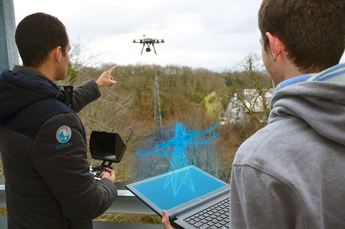
Affordable eyes in the sky, drones have fast become a popular and versatile tool for land mapping. Now ESA-backed startup Sysveo has developed a way of integrating user-made augmented reality objects into a drone’s video stream.
This allows the drone operator to analyse data in real time and adapt the flight accordingly, making operations more time- and cost-efficient.
As a drone documents the site of new infrastructure, for instance, the operator could see how it would appear in the landscape.
Sysveo, specialising in customised drone integration for professional users, is a French company supported through ESA’s Business Incubation Centre Sud France. As well as augmented reality, Sysveo also provides anti-collision and indoor geolocalisation software for its drones.
Source: esa.int
